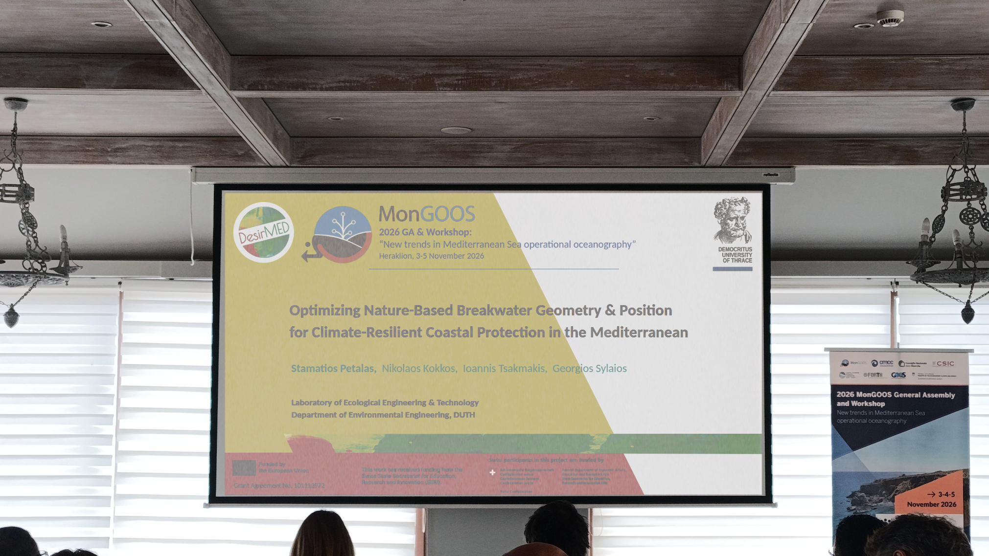
DesirMED was at the MonGOOS 2026 General Assembly & Workshop (“New trends in Mediterranean Sea operational oceanography”) held in Heraklion, Crete (3–5 November 2026), coastal resilience and operational modeling took center stage.
The contribution from the Laboratory of Ecological Engineering & Technology (Department of Environmental Engineering, Democritus University of Thrace - DUTH), demonstrated how advanced computer modeling and smart algorithms can optimize Nature-Based Solutions (NbS) to protect vulnerable Mediterranean shorelines.
Presented by Dr Stamatios Petalas, the study, titled "Optimizing Nature-Based Breakwater Geometry & Position for Climate-Resilient Coastal Protection in the Mediterranean", highlighted how ocean monitoring supports climate adaptation under the Horizon Europe DesirMED project framework.
In this context, DUTH, in collaboration with the Region of Eastern Macedonia and Thrace (REMTH) and the Municipality of Paggaio, is deploying and evaluating a suite of targeted Pilot Actions (PAs):
- PA1: Check-dams for upstream flood prevention
- PA2: Smart-irrigation systems for agricultural water stewardship
- PA3: Constructed wetlands for water quality and ecosystem management
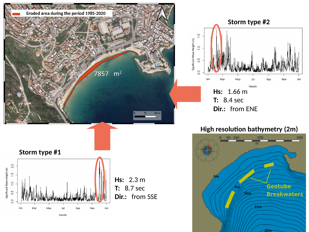
- PA4: Geotube low-crested breakwaters for coastal erosion mitigation
DUTH’s presentation at the MonGOOS workshop focused on PA4, addressing the growing threat of beach erosion at Kalamitsa Beach in Kavala.
Rethinking Shoreline Defense
Conventional "hard" engineering structures, such as concrete breakwaters, can disrupt local marine life, carry high installation costs, and often cause unintended erosion further down the coast.
Geotubes, large, durable textile containers filled with locally sourced beach sand, offer a flexible, low-impact, eco-friendly alternative:
- Key Advantages: Lower installation and maintenance costs, use of local sand, seamless integration into the natural underwater landscape, and the flexibility to be moved or removed if conditions change.
- Engineering Challenge: Without proper placement, geotextiles can suffer wear from ocean waves, and local authorities often lack standardized guidelines on precisely where to place them for maximum benefit.
To overcome these hurdles, DUTH built an automated digital simulation pipeline to calculate the exact placement and shape needed for geotube breakwaters to absorb maximum wave energy.
Leveraging European Ocean Data
To test how geotubes perform during severe storms, the DUTH research team combined offshore wave data with high-resolution fluid dynamics simulations:
- Real-World Ocean Data: Offshore storm conditions were drawn directly from the Copernicus Marine Service (CMEMS), feeding realistic Mediterranean storm patterns into the digital model.
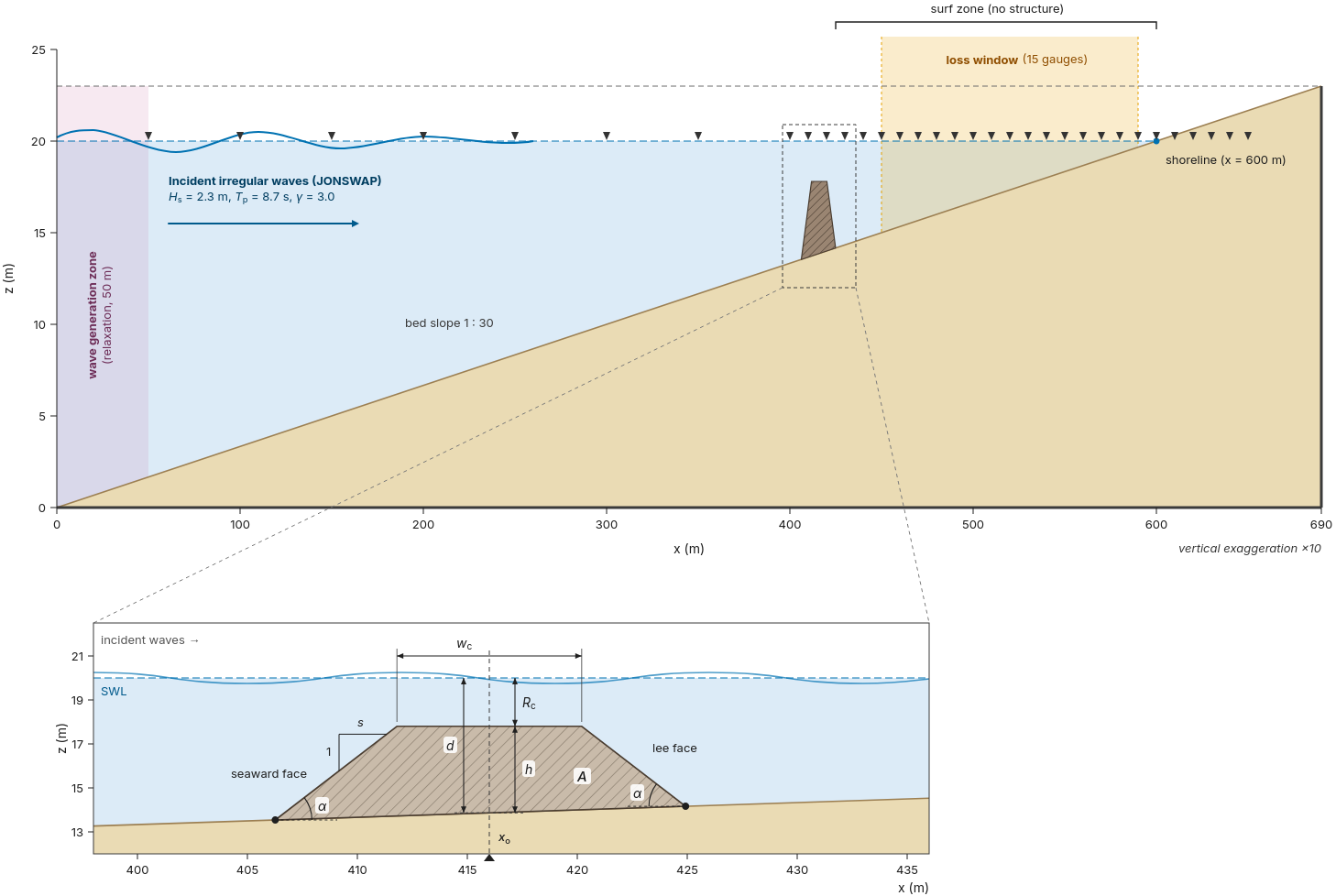
- Simulating Wave Physics: Using the REEF3D wave-modeling software, the team simulated how deep-water storm waves transform, break, and lose energy as they move into shallow coastal waters.
- Virtual Pilot Testing (Kalamitsa Beach): A detailed 3D map of Kalamitsa’s sea floor was created to test various underwater and surface breakwater setups at depths of 4 to 5 meters.
Smart Optimization: Solving the Breakwater Puzzle
Finding the ideal breakwater design requires balancing four interconnected choices:
- Distance from Shore: How far out to place the structure
- Side Slope : How steep or gradual the sides should be.
- Top Width: How wide the crest needs to be
- Underwater Depth : How deep below the water surface the top of the breakwater sits.
However, testing every possible combination manually using complex fluid dynamic models would take excesive computational resources.
The Solution: Faster, Smarter Computer Optimization
To solve this efficiently, DUTH applied an intelligent optimization algorithm known as SPSA (Simultaneous Perturbation Stochastic Approximation).
Instead of testing thousands of random design combinations, the algorithm evaluates multiple design factors simultaneously, arriving at the optimal setup with only a fraction of the usual computing steps:
- Smart Mapping: The team mapped out the coastal design area to ensure the algorithm wouldn't get stuck on partial improvements.
- Automated Fine-Tuning: The system ran automated trial loops, steering the design toward the layout that absorbs the maximum amount of wave energy.
Key Results: Maximum Coastal Protection with Minimum Material
The smart design optimization provided clear, practical engineering numbers for the Kalamitsa pilot site:
- Ideal Position: 420 meters offshore
- Ideal Slope: 1: 2.8 gradient
- Ideal Crest Width: 7.4 meters
- Ideal Depth Below Surface: 2.3 meters
Practical Takeaways
- Wave Energy Reduction: The optimal breakwater arrangement reduces destructive wave energy by nearly 27%.
- Submerged Protection: Placing the breakwater crest just below average storm-wave height near the natural wave-breaking line protects the entire shoreline while keeping the structure invisible from the beach.
Next Steps for DesirMED and Mediterranean Coastal Protection
DUTH’s work bridges the gap between operational oceanography and practical, nature-based coastal engineering. By combining Copernicus ocean data with Computational Fluid Dynamics and design algorithms, the research team has created a clear, practical model for coastal managers across the Mediterranean.